St John's Way (South)
St John's Way
The southern Pilgrimage of Hope Way from Southwark and Westminster Cathedrals in London to St Barnabas' Cathedral in Nottingham via the Cathedral of Our Lady Immaculate & St Thomas of Canterbury in Northampton.
Patron: St Anne Line (c. 1563 – 1601): English married lay woman, convert and martyr.
After the death of her husband, who had been banished for attending Mass, Anne was active in sheltering clandestine Catholic priests. Finally arrested, she was condemned to death and executed at Tyburn. She was canonised in 1970. Her feasts are: 27th February (individual), 25th October (with the Forty Martyrs of England & Wales), 30th August (with SS Margaret Ward and Margaret Clitherow).
Overview
The Way starts at the Cathedral of St George in Southwark and crosses the River Thames to reach Westminster Cathedral. It then passes through Royal parks to the Shrine of the Tyburn Martyrs. At Paddington the Grand Union Canal is reached. Apart from optional diversions to churches the Canal arm is followed to Northolt where the Way joins the Dog Rose Ramble and then the Hillingdon Trail. At Bayhurst Woods the Way diverts W to Harefield and soon rejoins the Grand Union Canal. Apart from diversions to Rickmansworth, Abbots Langley (birthplace of Adrian IV, the only English pope), and Leighton Buzzard the Canal is followed to Newport Pagnall. After the town the route follows the Three Shires Way, then the Midshires Way, the Northamptonshire Round and finally the Nene Way to Northampton Cathedral. The path leaves the city and rejoins the Midshires Way to Arthingworth and soon after follows the Brampton Valley Way to Market Harborough. The Way continues N on the Rutland Way and then the Leicestershire Round. Where this bends W the path follows the Jubilee Way to Melton Mowbray. The Way crosses farmland to reach Willoughby-in-the-Wolds where it breifly re-joins the Midshires Way before diverting to Keyworth. The Way heads towards Nottingham, briefly following a disused railway line, to finally reach Nottingham Cathedral.
Essential facts:
- Route length: 169.4 miles
- Ascent: 4,669 ft - the route is mostly very flat
- Peak elevation: 656 ft
- Average walk day length: 14.9 miles
- Average walk day duration: 6 hours
- Number of walking days: 12
- Number of rest days: 1
- Start date: Monday 1st September at St George's Cathedral, Southwark, London
- End date: Saturday 13th September 2025 at St Barnabas' Cathedral, Nottingham
- Pilgrims are invited to join the Solemn Mass for the Feast of the Exaltation of the Holy Cross at 11.15 on Sunday 14th September at St Barnabas' Cathedral.
St John's Way route map
For details of the day stages and parishes visited see below.
NB REGISTRATION FOR DAY HAS NOW CLOSED
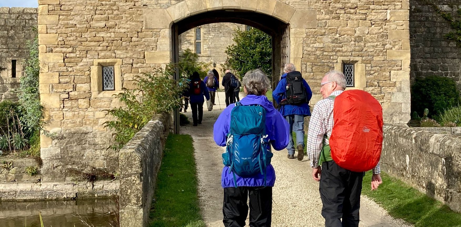
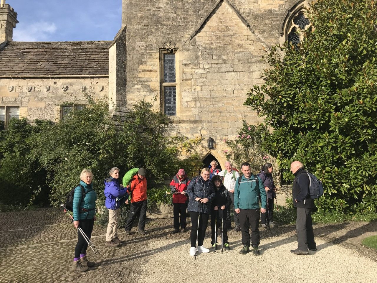
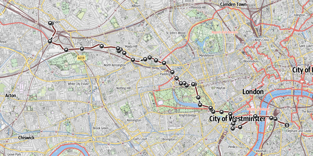
Stage 1: Southwark to Harlesden, Monday 1st September 2025
 DETAILS OF THE ROUTE
Details of the walk
Distance: 9.1 miles
Approximate time taken: 6 hours
Ascent: 180 ft
Where to join: The Cathedral of St George, Lambeth Rd, Southwark, London SE1 7HY
Time walk starts: 9am
Where walk ends: The Church of Our Lady of Willesden, 1 Nicoll Rd, Harlesden, London, NW10 9AX
Approximate time walk ends: 3pm
Accessible sections: The route is generally accessible for wheelchairs and buggies as far as Tyburn, although the roads are busy.
Shorter walk options
Walk A: St George’s Cathedral to Westminster Cathedral - 1.8 miles
Leave St George’s at 9am. Arrive Westminster Cathedral at 10am
Nearest tube/rail stations: Lambeth North and Waterloo for St George’s; Victoria and St James’s Park for Westminster Cathedral.
This walk is accessible for wheelchairs etc
Walk B: Westminster Cathedral to Tyburn Convent - 2.1 miles
Leave Westminster Cathedral at 10.30am. Arrive Tyburn Convent at 11.30am
Nearest tube/rail stations: Victoria and St James’s Park for Westminster Cathedral; Marble Arch for Tyburn Convent.
This walk is accessible for wheelchairs etc
Walk C: Tyburn Convent to Our Lady of Willesden - 5.3 miles
Leave Tyburn Convent at 12 noon. Arrive Our Lady of Willesden at 3.05pm
Nearest tube/rail stations: Marble Arch for Tyburn Convent; Willesden Junction for Our Lady of Willesden
This walk is not accessible for wheelchairs etc
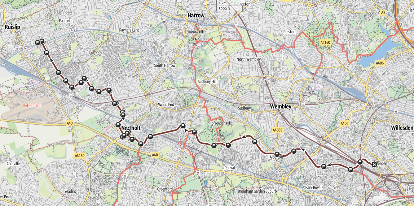
Stage 2: Harlesden to Ruislip, Tuesday 2nd September 2025
 DETAILS OF THE ROUTE
Details of the walk
Distance: 10.4 miles
Approximate time taken: 5.5 hours
Ascent: 85 ft
Where to join: The Church of Our Lady of Willesden, 1 Nicoll Rd, Harlesden, London, NW10 9AX
Time walk starts: 9.30am
Where walk ends: The Church of The Most Sacred Heart, 73 Pembroke Rd, Ruislip, HA4 8NN
Approximate time walk ends: 3.45pm
Accessible sections: The route is not accessible. There is a steep ramp to the canal near the beginning and steps to exit the canal at Northolt.
Shorter walk options
Walk A: Our Lady of Willesden to St Bernard’s RC Church, Northolt - 6.6 miles
Leave Our Lady of Willesden at 9.30am. Arrive at St Bernard’s at 12.40pm
Nearest tube/rail stations: Willesden Junction for Our Lady of Willesden; Northolt for St Bernard’s church
This walk is not accessible for wheelchairs etc.
Walk B: St Bernard’s Church, Northolt to St Gregory’s Church, South Ruislip - 2.6 miles
Leave St Bernard’s at 1.40pm. Arrive at St Gregory’s at 2.40pm
Nearest tube/rail stations: Northolt for St Bernard’s; South Ruislip for St Gregory’s
This walk is not accessible for wheelchairs etc.
Walk C: St Gregory’s Church, South Ruislip to Most Sacred Heart, Ruislip - 1.3 miles
Leave St Gregory’s at 3.10pm. Arrive at Most Sacred Heart at 3.45pm.
Nearest tube/rail stations: South Ruislip for St Gregory’s. Ruislip for Most Sacred Heart.
This walk is accessible for wheelchairs etc.
Stage 3: Ruislip to Rickmansworth, Wednesday 3rd September 2025
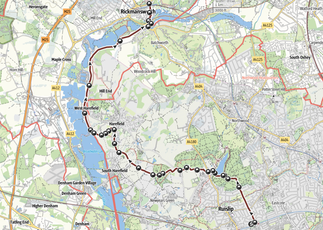 DETAILS OF THE ROUTE
Details of the walk
Distance: 9.3 miles
Approximate time taken: 6 hours
Ascent: 302 ft
Where to join: The Church of The Most Sacred Heart, 73 Pembroke Rd, Ruislip, HA4 8NN
Time walk starts: 9.30am
Where walk ends: The Church of Our Lady Help of Christians, 5 Park Rd, Rickmansworth, WD3 1HU
Approximate time walk ends: 3.20
Accessible sections: Not accessible for buggies or wheelchairs due to mud and hills.
Stage 4: Rickmansworth to Berkhampsted, Thursday 4th September 2025
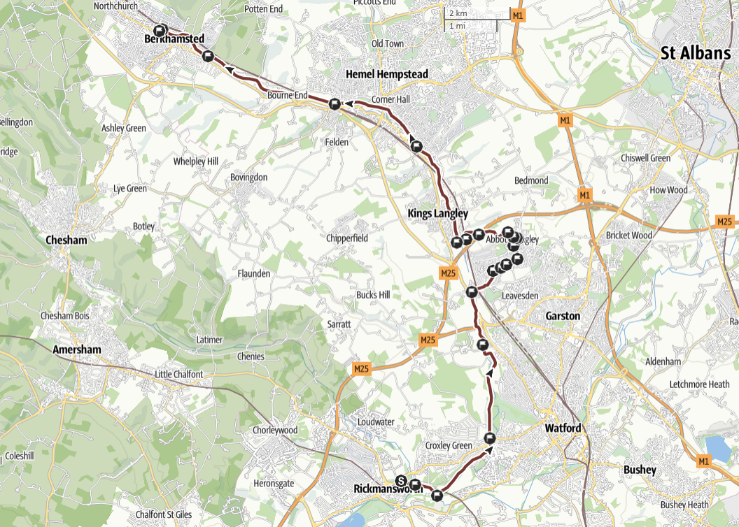 DETAILS OF THE ROUTE
Details of the walk
Distance: 16.7 miles
Approximate time taken: 8 hours
Ascent: 394 ft
Where to join: The Church of Our Lady Help of Christians, 5 Park Rd, Rickmansworth, WD3 1HU
Time walk starts: 9am
Where walk ends: The Church of the Sacred Heart, Park St, Berkhamsted, HP4 1HX
Approximate time walk ends: 4.20pm
Accessible sections: Not accessible except when pavements are available, e.g. Abbots Langley
Shorter walk option
D’Arcy’s Bar to Sacred Heart Church, Berkhamsted - 6miles
Leave D’Arcy’s Bar at 2pm. Arrive at Sacred Heart Church at 4.20pm
Public transport: Apsley station for D’Arcy’s Bar; Berkhamsted station for Sacred Heart Church
This walk is not accessible for wheelchairs etc.
Stage 5: Berkhampsted to Leighton Buzzard, Friday 5th September 2025
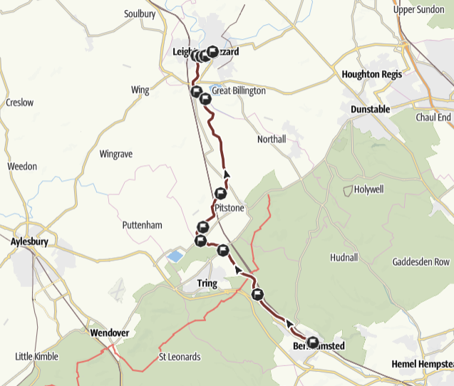 DETAILS OF THE ROUTE
Details of the walk
Distance: 15.2 miles
Approximate time taken: 7.5 hours
Ascent: 128 ft
Where to join: The Church of the Sacred Heart, Park St, Berkhamsted, HP4 1HX
Time walk starts: 9am
Where walk ends: The Church of the Sacred Heart, 5 Beaudesert, Leighton Buzzard, LU7 1HZ
Approximate time walk ends: 4.40pm
Accessible sections: Not accessible due to eroded, narrow and muddy towpath.
Stage 6: Leighton Buzzard to Newport Pagnall, Saturday 6th September 2025
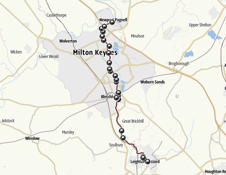 DETAILS OF THE ROUTE
Details of the walk
Distance: 16.2 miles
Approximate time taken: 8 hours
Ascent: 72 ft
Where to join: The Church of the Sacred Heart, 5 Beaudesert, Leighton Buzzard, LU7 1HZ
Time walk starts: 8.30am
Where walk ends: The Church of St Bede, High St, Newport Pagnell, MK16 0ED
Approximate time walk ends: 5pm
Accessible sections: Tow path is not accessible despite claims in publicity to the contrary - narrow, steps, steep slopes, erosion and improvement work in progress.
Stage 7: Newport Pagnell to Northampton, Sunday 7th September 2025
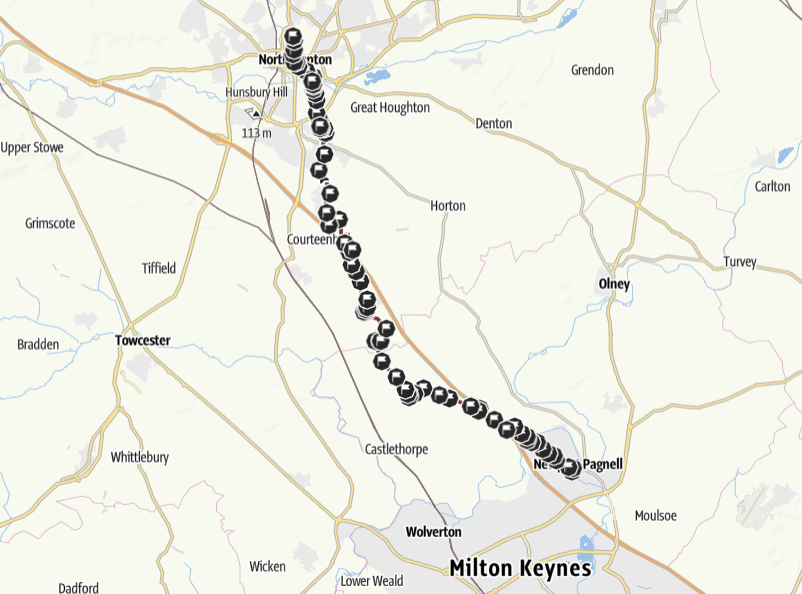 DETAILS OF THE ROUTE
Details of the walk
Distance: 17.4 miles
Approximate time taken: 9 hours
Ascent: 397 ft
Where to join: The Church of St Bede, High St, Newport Pagnell, MK16 0ED
Time walk starts: 8am
Where walk ends: The Cathedral of Our Lady Immaculate & St Thomas of Canterbury, Primrose Hill, Northampton, NN2 6AG
Approximate time walk ends: 5pm
Accessible sections: From 15.9 miles to the end the route is accessible: pavements and good quality paths
Shorter walk option
Midsummer Meadow car park, Northampton to Cathedral of Our Lady and St Thomas of Canterbury, Northampton - 2 miles
Leave the car park at 4.15pm. Arrive at Northampton Cathedral at 5pm (Mass at 5.15pm)
Parking available in the car park
This walk is accessible for wheel chairs etc.
Stage 8: Northampton to Market Harborough, Tuesday 9th September 2025
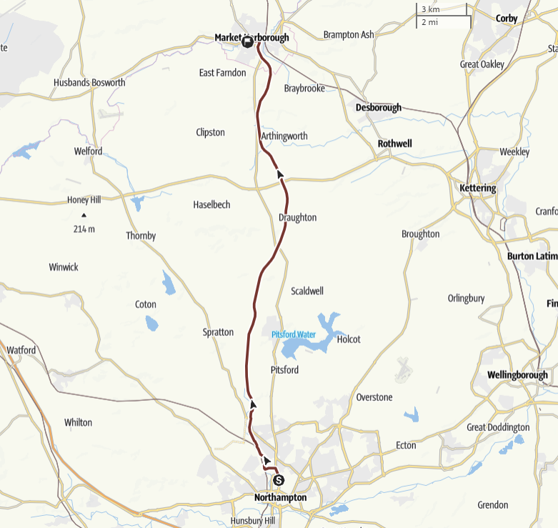 DETAILS OF THE ROUTE
Details of the walk
Distance: 18 miles
Approximate time taken: 9 hours
Ascent: 295 ft
Where to join: The Cathedral of Our Lady Immaculate & St Thomas of Canterbury, Primrose Hill, Northampton, NN2 6AG
Time walk starts: 8am
Where walk ends: The Church of Our Lady of Victories, 1 Fairfield Rd, Market Harborough, LE16 9QQ
Approximate time walk ends: 5.30pm
Accessible sections: Path is tarmac between 52.261090, - 0.913236 and The Windhover. There is possibly access through the estate but no obvious parking.
Good access at The Windhover.
Stage 9: Market Harborough to Belton in Rutland, Wednesday 10th September 2025
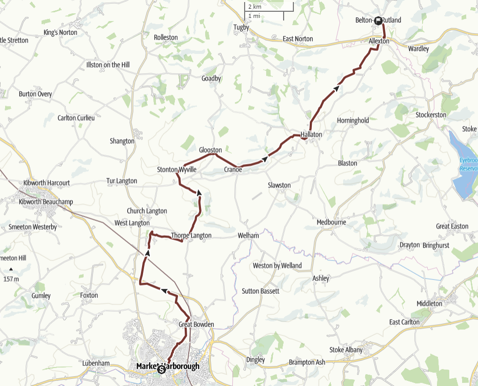 DETAILS OF THE ROUTE
Details of the walk
Distance: 15.9 miles
Approximate time taken: 8.5 hours
Ascent: 1,115 ft
Where to join: The Church of Our Lady of Victories, 1 Fairfield Rd, Market Harborough, LE16 9QQ
Time walk starts: 8.30am
Where walk ends: Belton in Rutland
Approximate time walk ends: 4.50pm
Accessible sections: Through Market Harborough town: other paths not suitable.
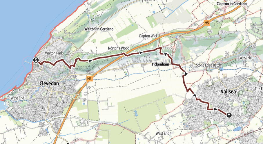
Stage 10: Belton in Rutland to Melton Mowbray, Thursday 11th September 2025
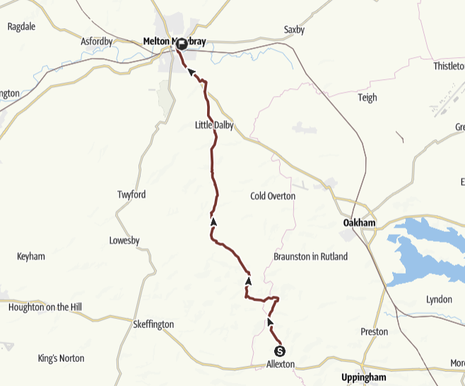 DETAILS OF THE ROUTE
Details of the walk
Distance: 14.7 miles
Approximate time taken: 8 hours
Ascent: 814 ft
Where to join: Belton in Rutland
Time walk starts: 8.30am
Where walk ends: The Church of St John the Baptist, 44 Thorpe End, Melton Mowbray, LE13 1RB
Approximate time walk ends: 4.35pm
Accessible sections: Burton Lazars to Melton Mowbray there is a paved path.
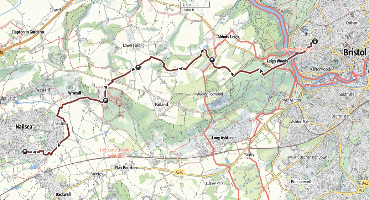
Stage 11: Melton Mowbray to Keyworth, Friday 12th September 2025
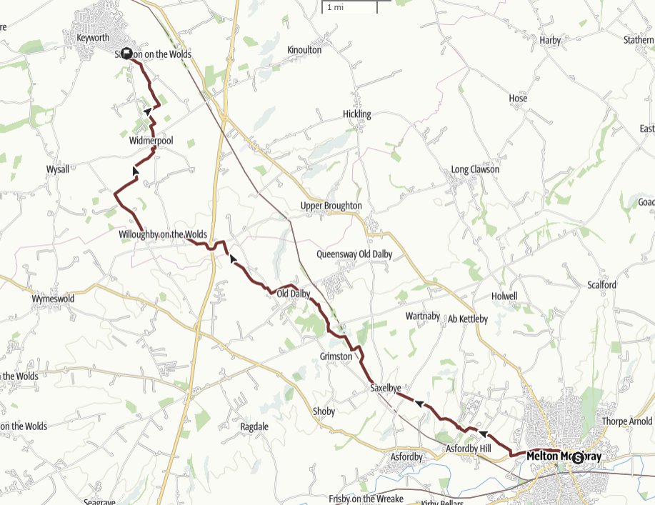 DETAILS OF THE ROUTE
Details of the walk
Distance: 15.1 miles
Approximate time taken: 7 hours
Ascent: 778 ft
Where to join: The Church of St John the Baptist, 44 Thorpe End, Melton Mowbray, LE13 1RB
Time walk starts: 9am
Where walk ends: The Church of St Margaret Clitherow, Willow Brk, Keyworth, NG12 5BB
Approximate time walk ends: 5pm
Accessible sections: Melton Mowbray town centre, the rest is farmland.
Stage 12: Keyworth to Nottingham, Saturday 13th September 2025
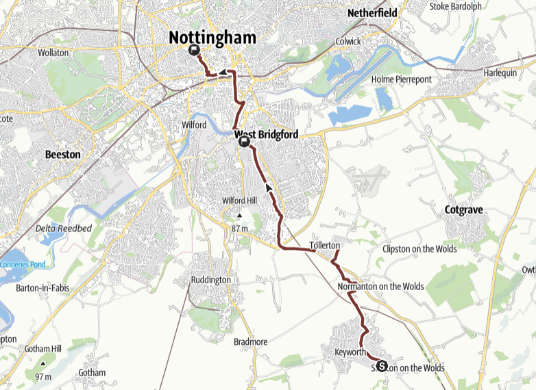 DETAILS OF THE ROUTE
Details of the walk
Distance: 9.6 miles
Approximate time taken: 4. hours
Ascent: 125 ft
Where to join: The Church of St Margaret Clitherow, Willow Brk, Keyworth, NG12 5BB
Time walk starts: 9.45am
Where walk ends: The Cathedral of St Barnabas, N Circle St, Nottingham, NG1 5AE
Approximate time walk ends: 3.15pm
Accessible sections: See below
Shorter walk options
Walk A: St Margaret Clitherow, Keyworth to Holy Spirit Church, West Bridgford - 6.4 miles
Leave St Margaret Clitherow at 9.45am. Arrive at Holy Spirit Church at 12.50pm.
Public transport: bus service from Nottingham bus station to Keyworth, the Keyworth (no 19)
This walk is not accessible for wheelchairs etc.
Walk B: Holy Spirit Church, West Bridgford to St Barnabas’ Cathedral, Nottingham - 2.9 miles
Leave Holy Spirit Church at 1.50pm. Arrive at St Barnabas’ Cathedral at 3.15pm
Public transport: bus service from Nottingham bus station to Holy Spirit Church, the Keyworth (no 19)
This walk is not accessible for wheelchairs etc.