St Mark's Way (North) to Nottingham
St Mark's Way
The northern Pilgrimage of Hope Way from Leeds Cathedral to St Barnabas' Cathedral in Nottingham via St Marie's Cathedral in Sheffield and the Chapel of the Padley Martyrs. St Mark the Evangelist was an Egyptian who is traditionally ascribed to be the author of the Gospel of Mark. According to Church tradition, Mark founded the episcopal see of Alexandria, which was one of the five most important sees of early Christianity. His feast day is celebrated on April 25, and his symbol is the winged lion.
Patron: St Hilda of Whitby (c. 614 – 680) abbess and key figure in the Anglo-Saxon Church.
Hilda founded and was the first abbess of the monastery at Whitby which was the venue for the Synod of Whitby in 664. She was widely recognised for her wisdom and learning and trained five bishops. Her feast is celebrated on 17th November.
Overview:
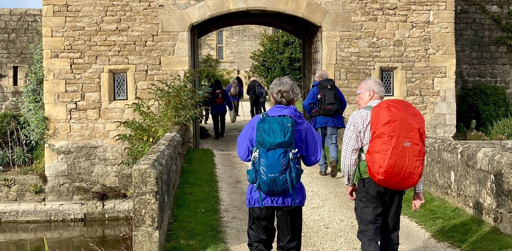
The Way starts at Leeds Cathedral and follows the Transpennine Trail (TPT) SE beside the Aire & Calder Navigation to Woodlesford. Here the path veers SW to re-join the TPT along a disused railway line and then the River Calder to Wakefield. The Way follows the TPT again beside the former Barnsley Canal and then along a disused railway to Wombwell. The route turns SW along the Barnsley Boundary Walk to Elsecar, and then across farmland to briefly join the Old Salt Rd, beside the A629. The Way soon joins the Sheffield Country Walk and follows this beside the Sheffield Canal to reach St Marie's Cathedral in central Sheffield. From here the Way joins the Padley Martyrs Way, leaving the city through Endcliffe Park and then climbing Houndkirk Moor to arrive at the Chapel of the Padley Martyrs. The path then follows the River Derwent to Matlock. The Way leaves the Derwent at Ambergate and turns east, through Ripley and then along the former Cromford Canal to Eastwood. Here the route joins the Robin Hood Way to Strelley where the Way veers E to Kingsbury and finally reaches St Barnabas' Cathedral, central Nottingham.
Essential facts:
- Route length: 105.9 miles
- Ascent 3,750 ft: The route is mostly flat with the only significant climb on Day 4 over Houndkirk Moor
- Peak elevation: 1,388 ft
- The Way can be followed using a GPX file (download using the button below).
St Mark's Way route
Possible day stages
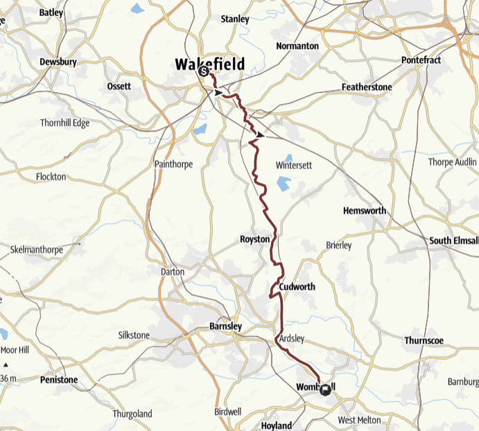
Stage 1: Leeds to Wakefield
 THE ROUTE IN DETAIL
Details of the walk
Distance: 15.6 miles
Approximate time taken: 6.5 hours walking
Ascent: 367 ft
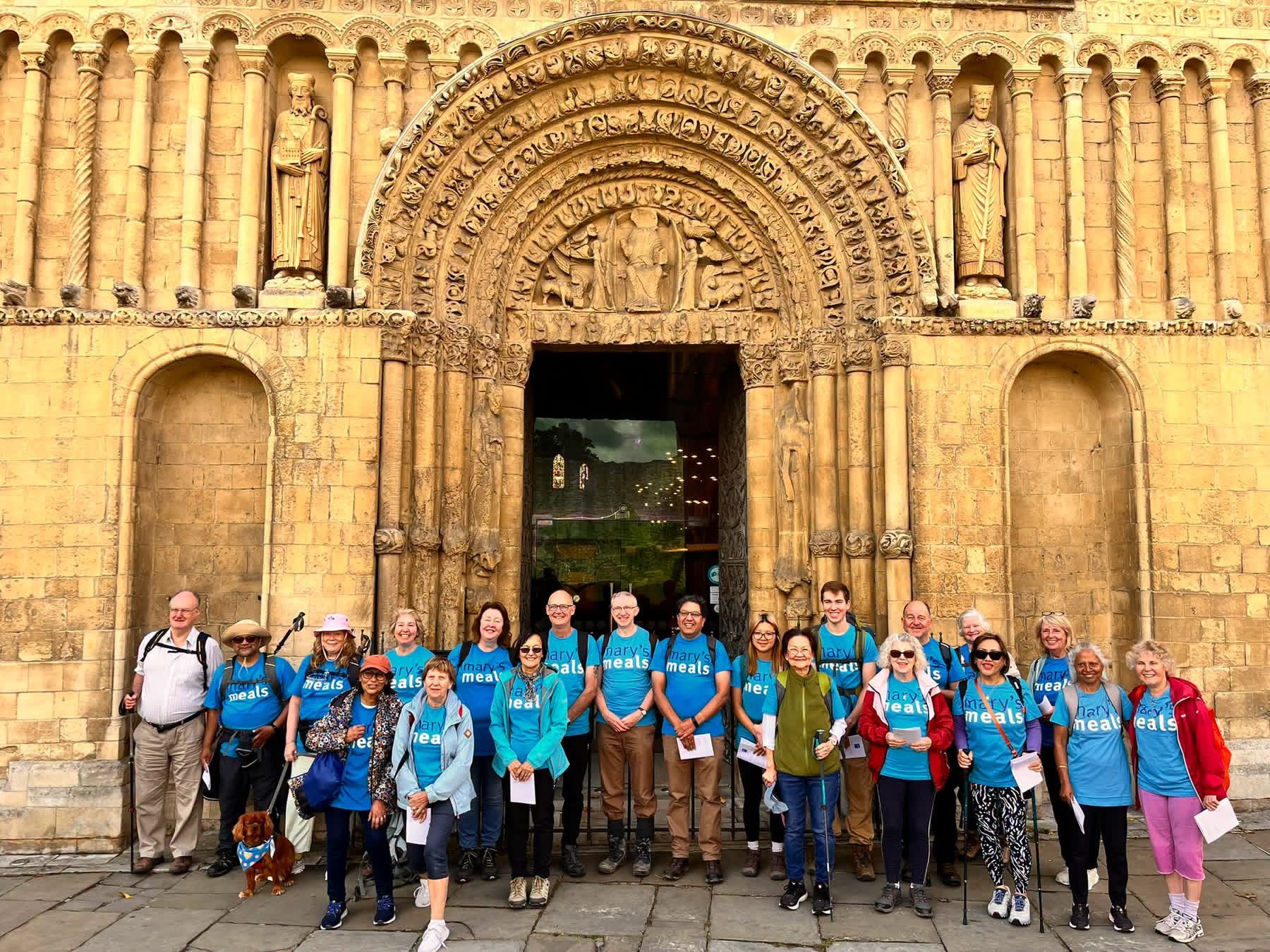
Start: Leeds Cathedral, Great George St, Leeds, LS2 8BE
End: St Austin's Catholic Church, 6 Wentworth Terrace, Wakefield, WF13QN
Accessible sections: Canal / riverside walking to Woodlesford. Buggies with some “carry” okay. Limited for wheelchairs due to bridge steps in places.
Shorter walks
A: St Anne's Cathedral to Woodlesford (Railway Station): approx 8 miles,
B: Woodlesford (Railway Station) to St Austin's Wakefield: approx 8 miles
Stage 2: Wakefield to Wombwell
 THE ROUTE IN DETAIL
Details of the walk
Distance: 17 miles
Approximate time taken: 7 hours walking
Ascent: 249 ft
Start: St Austin's Catholic Church, 6 Wentworth Terrace, Wakefield, WF13QN
End: St Michael & All Angels Catholic Church, 23 Park St, Wombwell, S73 0HQ
Accessible sections: This section should be usable by buggies but unfortunately not suitable for wheelchairs.
Shorter walks
A: St Austin's Wakefield to Royston (John the Baptist CoE Church) 9 miles
B: Royston (John the Baptist CoE Church) to St Michael & All Angels Church, Wombwell 8 miles
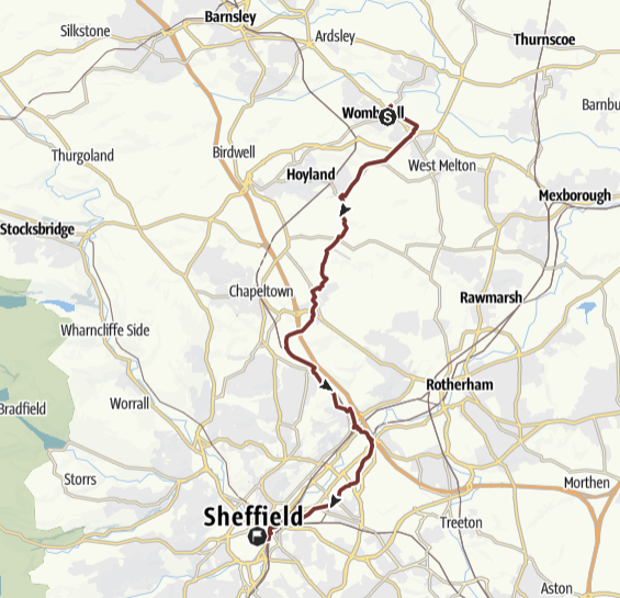
Stage 3: Wombwell to Sheffield
 THE ROUTE IN DETAIL
Details of the walk
Distance: 16.4 miles
Approximate time taken: 7 hours walking
Ascent: 807 ft
Start: St Michael & All Angels Catholic Church, 23 Park St, Wombwell, S73 0HQ
End: St Marie's Cathedral, Norfolk St, Sheffield, S1 2JB
Accessible sections: There is a paved section from Sheffield Canal Basin to St Marie's Cathedral.
Shorter walks
A: St Michael & All Angels, Wombwell to Meadowhall Interchange, 11 miles
B: Meadowhall Interchange to St Marie's Cathedral, Sheffield, 5 miles
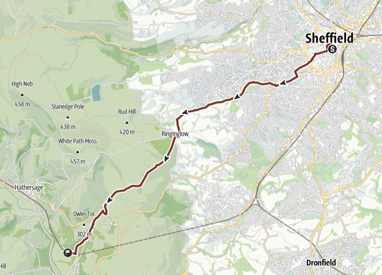
Stage 4: Sheffield to Padley
 THE ROUTE IN DETAIL
Details of the walk
Distance: 10.4 miles
Approximate time taken: 5 hours walking
Ascent: 1,155 ft (significant climb over moor)
Start: St Marie's Cathedral, Norfolk St, Sheffield, S1 2JB
End: Padley Martyrs Chapel, Grindleford, S32 2JA
Accessible sections: Between 2.8 mls to 5 mls into the walk there is paved paths, but road crossings are involved.
Shorter walks
A: St Marie's Cathedral to the Norfolk Arms pub (Ringinglow), 6 miles
B: Norfolk Arms pub (Ringinglow) to Padley Chapel, 5 miles.
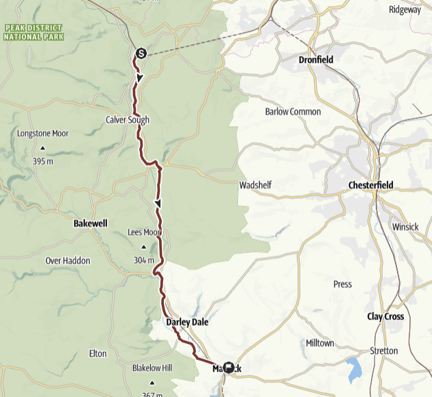
Stage 5: Padley to Matlock
 THE ROUTE IN DETAIL
Details of the walk
Distance: 15.5 miles
Approximate time taken: 6 hours walking
Ascent: 75 ft
Start: Padley Martyrs Chapel, Grindleford, S32 2JA
End: Our Lady & St Joseph's Catholic Church, 1 St Joseph's St, Matlock, DE4 3NG
Accessible sections: At 5 mls into the walk there are good paths through the estate from Baslow to Chatworth House.
Shorter walks
A: Padley Chapel to Chatsworth (Queen Mary's Bower near the bridge over the River Derwent, 8 miles
B: Chatsworth (Queen Mary's Bower) to Our Lady & St Joseph, Matlock, 8 miles
Stage 6: Matlock to Ripley
 THE ROUTE IN DETAIL
Details of the walk
Distance: 13.1 miles
Approximate time taken: 5 hours walking
Ascent: 656 ft
Start: Our Lady & St Joseph's Catholic Church, 1 St Joseph's St, Matlock, DE4 3NG
End: St Joseph's Catholic Church, Butterley Hill, Ripley, DE5 3LW
Accessible sections: Start of Cromford Canal to Aqueduct cottage is wheelchair accessible.
Shorter walks
A: Our Lady & St Joseph, Matlock to Ambergate Station, 10 miles
B: Ambergate Station to St Joseph's Ripley, 5 miles
Stage 7: Ripley to Eastwood
 THE ROUTE IN DETAIL
Details of the walk
Distance: 8.3 miles
Approximate time taken: 4 hours walking
Ascent: 217 ft
Start: St Joseph's Catholic Church, Butterley Hill, Ripley, DE5 3LW
End: Our Lady of Good Counsel Catholic Church, 280 Nottingham Rd, Eastwood, Nottingham, NG16 2AQ
Accessible sections: None suitable. At Codnor Park Reservior there is a car park and walk by the canal.
Stage 8: Eastwood to Nottingham
 THE ROUTE IN DETAIL
Details of the walk
Distance: 9.6 miles
Approximate time taken: 4 hours walking
Ascent: 361 ft
Start: Our Lady of Good Counsel Catholic Church, 280 Nottingham Rd, Eastwood, Nottingham, NG16 2AQ
End: The Cathedral of St Barnabas, N Circus St, Nottingham, NG1 5AE
Accessible sections: From All Saints Church, Main St, Strelly NG8 6PE to the end there is a pedestrian path, although sometimes it is quite narrow and you might need to go onto the road.