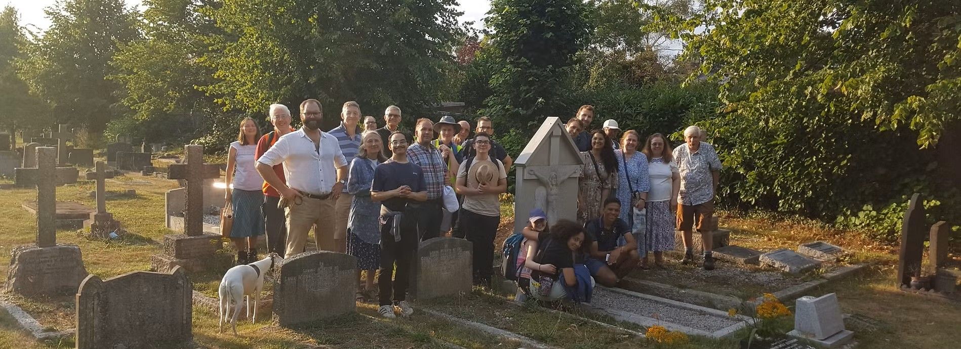
St Matthew's Way (West)
St Matthew's Way
The western Pilgrimage of Hope Way from St David's Cathedral in Cardiff to St Barnabas' Cathedral in Nottingham via St Chad's Cathedral in Birmingham and the Shrine of St Chad in Lichfield.
Patron: St Melangell (c 7th or 8th Century) Welsh hermit, consecrated virgin and abbess.
According to her hagiography, Melangell was a princess who fled an arranged marriage and became a consecrated virgin in the wilderness of Powys. She saved a hare from a prince's hunting dogs and is associated with protection of wildlife. Her feast is celebrated on 27th May.
Overview:
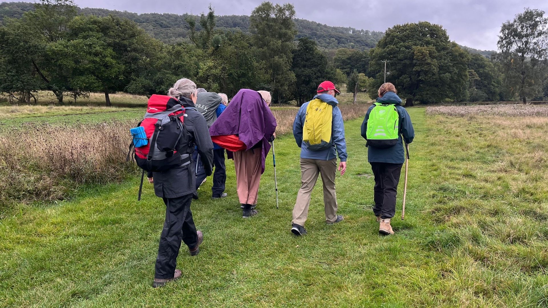
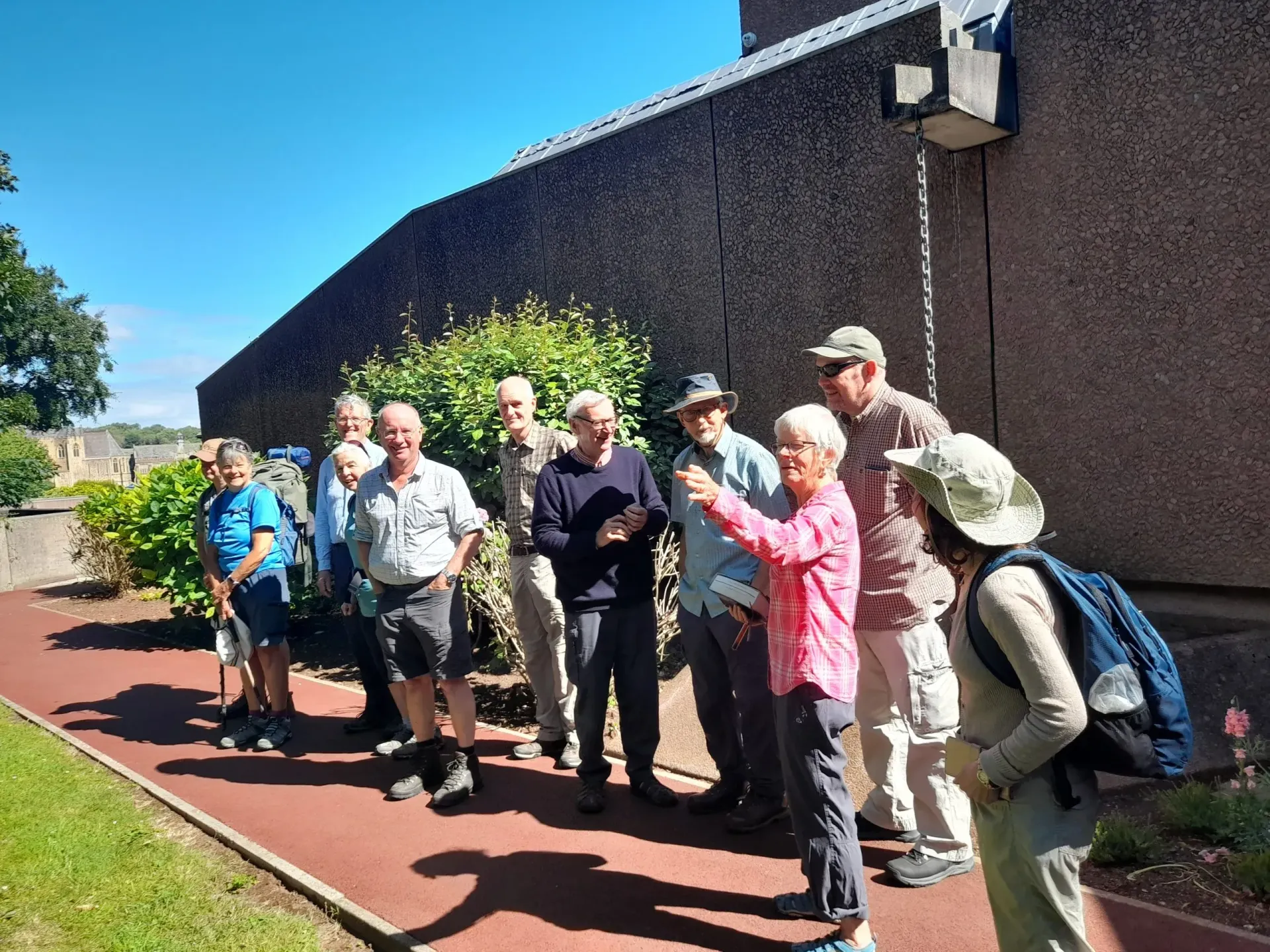
The Way starts at St David's Cathedral in Cardiff. The route soon joins the Welsh Coast Path to Newport and then Chepstow. Here the Way turns inland following the Offa's Dyke Path through the Wye Valley to Monmouth. The route follows the Wye Valley Walk to Ross-on-Wye where the Way joins the Herefordshire Trail to Ledbury. The Geopark Way and the Three Choirs Way (3CW) are followed over the Malvern Hills. After Malvern the Way continues on the 3CW until the River Severn is crossed and followed to Worcester. The Monarch's Way is followed to Droitwich Spa and then the Wychavon Way and John Corbett Way to Bromsgrove Spa. Here the Monarch's Way is regained until just before Illey the Way diverts into central Birmingham along the Illey Way. From the Cathedral of St Chad in Birmingham the Way follows the St Chad's Way, at first along canal towpaths. The Way passes through Sutton Coldfield before joining the Heart of England Way to Lichfield. The route joins the Trent & Mersey Canal towpath to Burton upon Trent and then on to Sawley. Here the Way diverts to Long Eaton and then follows the Way of Blessed Cyprian Tansi along the Broxtowe Country Trail and finally the Beeston Canal towpath to central Nottingham and the Cathedral of St Barnabas.
Essential facts:
- Route length: 210.2 miles
- Ascent: 10,955 ft
- Peak elevation: 1,378 ft
- Average walk day length: 14 miles
- Average walk day duration: 6-7 hours
- First walking day: Thursday 28th August 2025
- Number of walking days: 15
- Number of rest days: 2
- End date: Saturday 13th September 2025 at St Barnabas' Cathedral, Nottingham
- Pilgrims are invited to join the Solemn Mass for the Feast of the Exaltation of the Holy Cross at 11.15 on Sunday 14th September at St Barnabas' Cathedral.
St Matthew's Way route
For details of the day stages and parishes visited see below.
NB REGISTRATION FOR DAY PILGRIMAGES HAS NOW CLOSED.
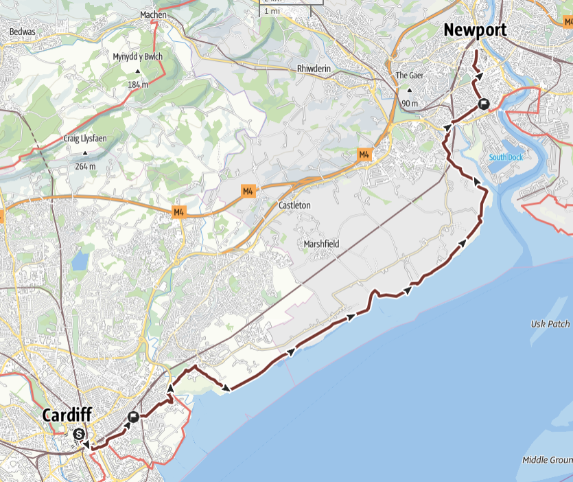
Stage 1: Cardiff to Newport, Thursday 28th August 2025
 THE ROUTE IN DETAIL
Walk overview
The Way leaves central Cardiff through Splott, passing the Cardiff Oratory. The Welsh Coast Path is reached and followed to the outskirts of Newport. This section is flat and remote. There are no facilities after leaving Splott.
Details
Distance: 15.3 miles
Approximate time taken: 8 hours walking
Ascent: 233 ft
Where to join: St David's Cathedral, 38 Charles St, St David's Centre, Cardiff, CF10 2SF
Time walk starts: 9.00 am
Where walk ends: St Mary's Catholic Church, 9 Stow Hill, Newport NP20 1TP
Approximate time walk ends: 5pm
Accessible sections: None identified
Shorter walk options
From Cardiff Cathedral to the Oratory at Splott. Start 9am, distance 1.6 miles ETA 10am. Return transport to central Cardiff by foot or bus.
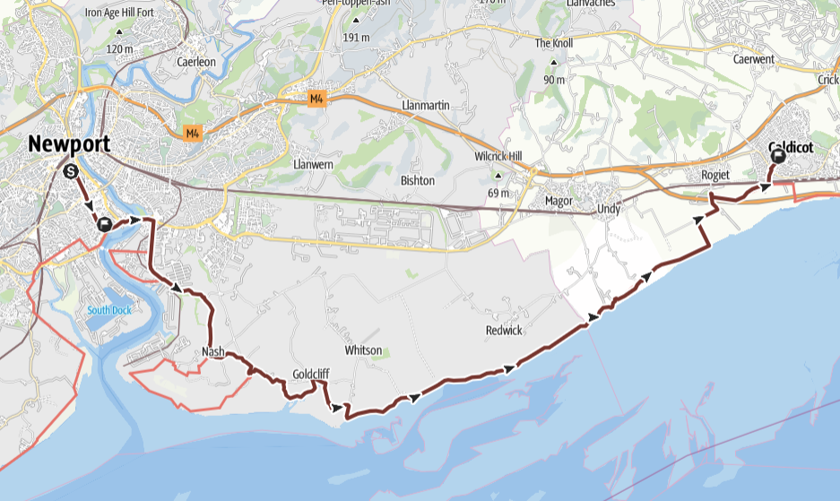
Stage 2: Newport to Caldicott, Friday 29th August 2025
 THE ROUTE IN DETAIL
Walk overview
A long but flat walk, mostly along the Welsh Coast Path. There are no facilities after Goldcliff.
Details of the walk
Distance: 16.6 miles
Approximate time taken: 8 hours walking
Ascent: 69 ft
Where to join: St Mary's Catholic Church, Stow Hill, Newport, NP20 1TP
Time walk starts: 9am
Where walk ends: The Church of St Paul, Longcroft Rd, Caldicot, NP26 4EX
Approximate time walk ends: 5pm
Accessible sections: From 15.1 miles at a junction just south of Severn Tunnel Junction there is a wide tarmac path to Caldicot.
Shorter walk options
St Mary’s Church, Newport to Goldcliff: 6.8 miles, start 9am, ETA 12md. Walkers will need to arrange to be collected by car.
Stage 3: Caldicott to Chepstow, Saturday 30th August 2025
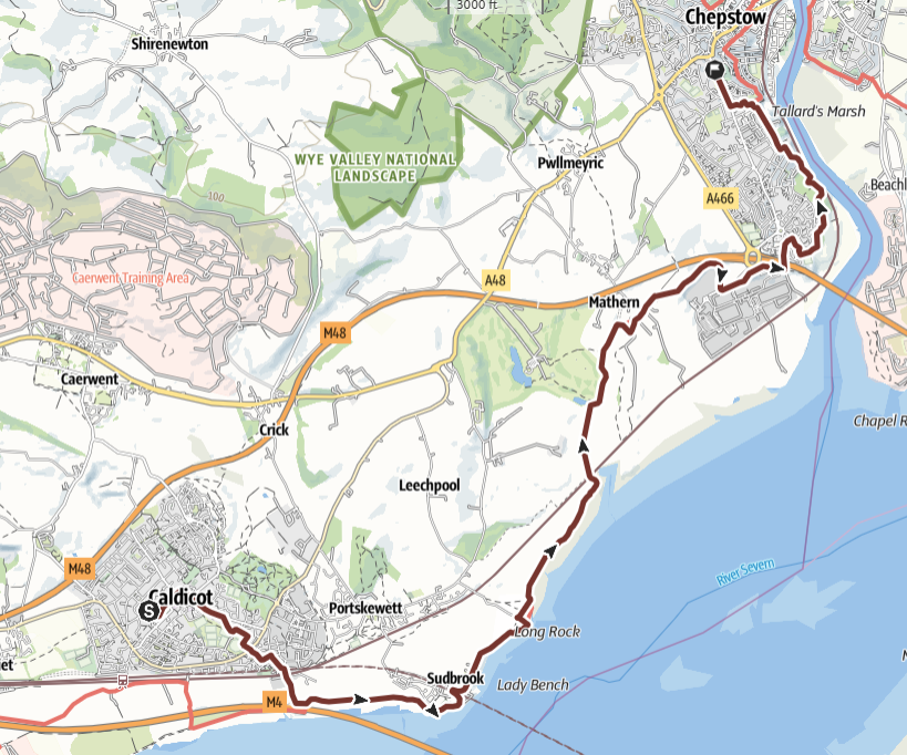 THE ROUTE IN DETAIL
Walk overview
A short but varied walk along the Welsh Coast Path and then through quiet countryside.
Details
Distance: 8.6 miles
Approximate time taken: 5 hours walking
Ascent: 431 ft
Where to join: St Paul's Catholic Church, Longcroft Rd, Caldicot, NP26 4EX
Time walk starts: 9am
Where walk ends: St Mary's Catholic Church, Bulwark Rd, Chepstow, NP16 5JE
Approximate time walk ends: 4pm
Accessible sections: None identified
Shorter walk options
A short day so none planned
Stage 4: Chepstow to Monmouth, Sunday 31 August 2025
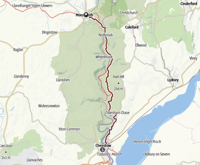 THE ROUTE IN DETAIL
Walk overview
A hilly and strenuous walk above the River Wye along the Offa’s Dyke Path.
Details
Distance: 17.2 miles
Approximate time taken: 9 hours walking
Ascent: 2,913 ft
Where to join: St Mary's Catholic Church, Bulwark Rd, Chepstow, NP16 5JE
Time walk starts: 8.30am
Where walk ends: St Mary's Catholic Church, St Mary's St, Monmouth, NP25 3DB
Approximate time walk ends: 6pm
Accessible sections: None identified
Shorter walk options
St Mary’s, Chepstow, leaving the route at 7.5 miles near Brockweir. Start 08.30 am ETA 11.30 am. Return transport: the 69 bus runs from infrequently from Brockweir Bridge to Chepstow.
Stage 5: Monmouth to Ross-on-Wye, Monday 1st September 2025
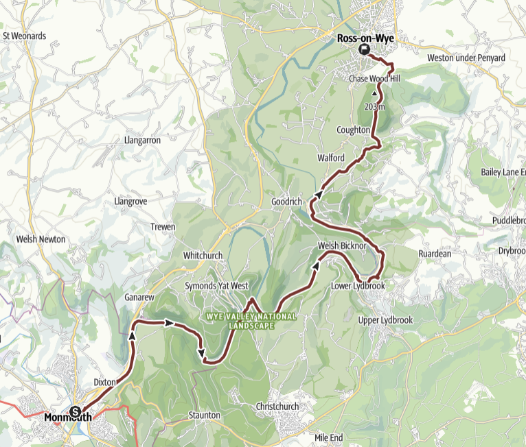 THE ROUTE IN DETAIL
Walk overview
A long but largely gentle riverside walk. It does include a cable suspension bridge which may preclude walkers with a fear of heights. There are steep hills near Symonds Yat and before reaching Monmouth.
Details of the walk
Distance: 16.4 miles
Approximate time taken: 8 hours walking
Ascent: 1,499 ft
Where to join: St Mary's Catholic Church, St Mary's St, Monmouth, NP25 3DB
Time walk starts: 9am
Where walk ends: St Frances Catholic Church, Sussex Ave, Ross-on-Wye, HR9 5AL
Approximate time walk ends: 5pm
Accessible sections: None identified
Shorter walk options
AM: St Mary’s, Monmouth to Lower Lybrook: Distance 9 miles, start 9am, ETA 12.30.
PM: Lower Lybrook to St Frances, Ross on Wye: distance 7.4 miles, start 1pm ETA 5pm
Return transport: the 35 bus runs infrequently from Monmouth and Ross on Wye to Lower Lydbrook.
Stage 6: Ross-on-Wye to Ledbury, Tuesday 2nd September 2025
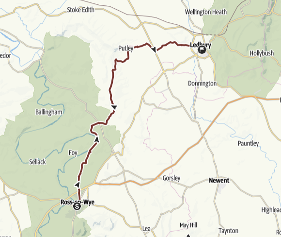 THE ROUTE IN DETAIL
Walk overview
A long and strenuous walk across quiet countryside with some hills and no facilities enroute.
Details
Distance: 16.2 miles
Approximate time taken: 8 hours walking
Ascent: 997 ft
Where to join: St Frances Catholic Church, Sussex Ave, Ross-on-Wye, HR9 5AL
Time walk starts: 9.00
Where walk ends: Most Holy Trinity Catholic Church, 70 New St, Ledbury, HR8 2EE
Approximate time walk ends: 5pm
Accessible sections: None identified
Shorter walk options
There are no obvious shorter options.
Stage 7: Ledbury to Malvern, Thursday 4th September 2025
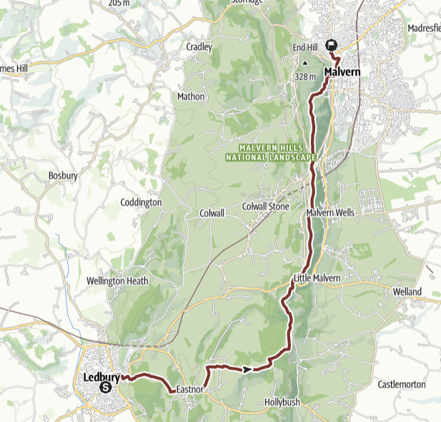 THE ROUTE IN DETAIL
Walk overview
A beautiful but strenuous walk through the Malvern Hills.
Details
Distance: 11.3 miles
Approximate time taken: 6 hours walking
Ascent: 2,070 ft
Where to join: Most Holy Trinity Catholic Church, 70 New St, Ledbury, HR8 2EE
Time walk starts: 9am
Where walk ends: St Joseph's Catholic Church, 125 Newtown Rd, Malvern, WR14 1PF
Approximate time walk ends: 4pm
Accessible sections: None identified
Shorter walk options
AM: Holy Trinity, Ledbury to British Camp, distance 6 miles, start 9am ETA 12md
PM: British Camp to St Joseph’s Malvern, distance 5.3 miles, start 1pm ETA 4pm
Pilgrims would need to arrange their own transport by car to or from British Camp.
Stage 8: Malvern to Worcester, Friday 5th September 2025
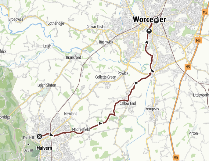 THE ROUTE IN DETAIL
Walk overview
Mostly easy, flat walking. No facilities on route apart from at frormer Stanbrook Abbey Hotel restaurant.
Details
Distance: 9.8 miles
Approximate time taken: 4 hours walking
Ascent: 207 ft
Where to join: St Joseph's Catholic Church, 125 Newtown Rd, Malvern, WR14 1PF
Time walk starts: 9am
Where walk ends: St George's Catholic Church, 1 Sansome Place, Worcester, WR1 1UG
Approximate time walk ends: 3pm
Accessible sections: The only parts of route suitable are in built up areas: In Malvern from start to SO 79181 47582; and from footbridge at SO 84758 53160 to entrance to Cathedral Garden, then there are steps to road level; through streets to St Georges is OK
Shorter walk options
No shorter options planned.
Stage 9: Worcester to Bromsgrove, Saturday 6th September 2025
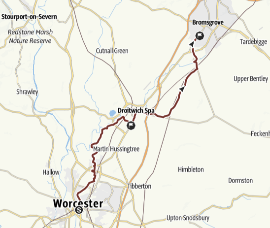 THE ROUTE IN DETAIL
Walk overview
Long but fairly flat walk, some canal towpaths and difficult stiles.
Details
Distance: 16.3 miles
Approximate time taken: 7 hours walking
Ascent: 394 ft
Where to join: St George's Catholic Church, 1 Sansome Place, Worcester, WR1 1UG
Time walk starts: 9am
Where walk ends: St Peter's Catholic Church, Rock Hill, Bromsgrove, B61 7LH
Approximate time walk ends: 5pm
Accessible sections: From:
1. St Georges to canal bridge 17 and
2. Valley Walk to church.
Shorter walk options
AM: St George’s, Worcester to Sacred Heart & St Catherine, Droitwich Spa, distance 8.3 miles, start 9am ETA 12.30
PM: Sacred Heart & St Catherine, Droitwich Spa to St Peter’s Bromsgrove, distance 8 miles, start 1pm, ETA 5pm
Return transport: there are trains and buses from and to Droitwich Spa from Worcester and Bromsgrove.
Stage 10: Bromsgrove to Harbourne, Sunday 7th September 2025
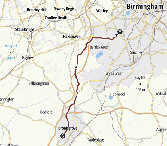 THE ROUTE IN DETAIL
Walk overview
Mostly easy walking, gently uphill then down.
Details
Distance: 13.4miles
Approximate time taken: 6 hours walking
Ascent: 961 ft
Where to join: St Peter's Catholic Church, Rock Hill, Bromsgrove, B61 7LH
Time walk starts: 9am
Where walk ends: St Mary's Catholic Church, Vivian Rd, Harbourne, Birmingham, B17 0DN
Approximate time walk ends: 4pm
Accessible sections: None identified
Shorter walk options
No shorter options identified.
Stage 11: Harbourne to Sutton Coldfield, Monday 8th September 2025
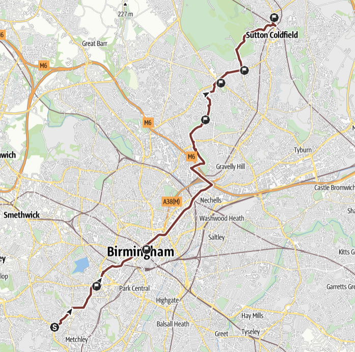 THE ROUTE IN DETAIL
Walk overview
Urban and mainly flat. Some canal towpath walking.
Details
Distance: 13.7 miles
Approximate time taken: 6 hours walking
Ascent: 443 ft
Where to join: St Mary's Catholic Church, Vivian Rd, Harbourne, Birmingham, B17 0DN
Time walk starts: 8am
Where walk ends: Holy Trinity Catholic Church, 69 Lichfield Rd, Sutton Coldfield, B74 2NU
Approximate time walk ends: 5pm
Accessible sections: Birmingham Canals possibly passable with an off-road buggy. Please check in advance. Wheelchair access inadvisable.
Shorter walk options
St Mary’s, Harbourne to St Chad’s Cathedral, distance 3.8 miles, start 8am, ETA 10.30am
St Chad’s Cathedral to St Margaret Mary, Perry Common, distance 5.2 miles, start 11am, ETA 3pm.
Return transport: there are buses from and to the City Centre from Harbourne and Perry Common.
Stage 12: Sutton Coldfield to Lichfield, Tuesday 9th September 2025
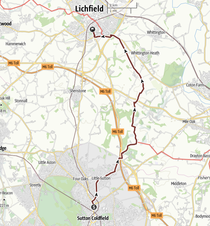 THE ROUTE IN DETAIL
Walk overview
Fairly flat, rural, may cross HS2 works. There are no facilities after Roughley.
Details
Distance: 10.6 miles
Approximate time taken: 5 hours walking
Ascent: 354 ft
Where to join: Holy Trinity Catholic Church, 69 Lichfield Rd, Sutton Coldfield, B74 2NU
Time walk starts: 9am
Where walk ends: Holy Cross Catholic Church, Upper St John St, Lichfield, WS14 9DX
Approximate time walk ends: 4pm
Accessible sections:
1. Holy Trinity to Weeford Road
2. Horse and Jockey (52°40'17.5"N 1°47'59.0"W) to Holy Cross, Lichfield
Shorter walk options
No suitable shorter walks identified.
Stage 13: Lichfield to Burton upon Trent, Thursday 11th September 2025
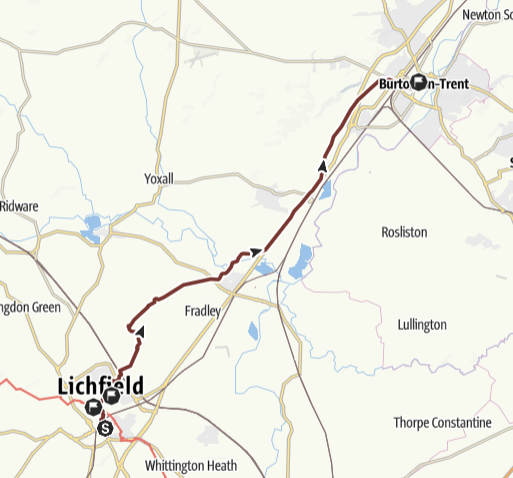 THE ROUTE IN DETAIL
Walk overview
Generally flat, easy walking, a lot of it beside the canals
Details
Distance: 15.2 miles
Approximate time taken: 7 hours walking
Ascent: 66 ft
Where to join: outside Lichfield Cathedral, The Close, Lichfield, WS13 7LD
Time walk starts: 9am
Where walk ends: SS Mary & Modwen Catholic Church, 78a Guild St, Burton-on-Trent, DE14 1NB
Approximate time walk ends: 5pm
Accessible sections:
1. Holy Cross, Lichfield to Chadswell Heights (52°41'46.9"N 1°48'56.5"W)
Shorter walk options
Lichfield Cathedral to Alrewas (Church Rd canal bridge), distance 7.1 miles, start 9am, ETA 12.30
Alrewas (Church Rd canal bridge) to SS Mary & Modwen, Burton on Trent, distance 8.1 miles, start 1pm ETA 5pm. There are buses from and to Alrewas from Lichfield and Burton on Trent
Stage 14: Burton upon Trent to Long Eaton, Friday 12th September 2025
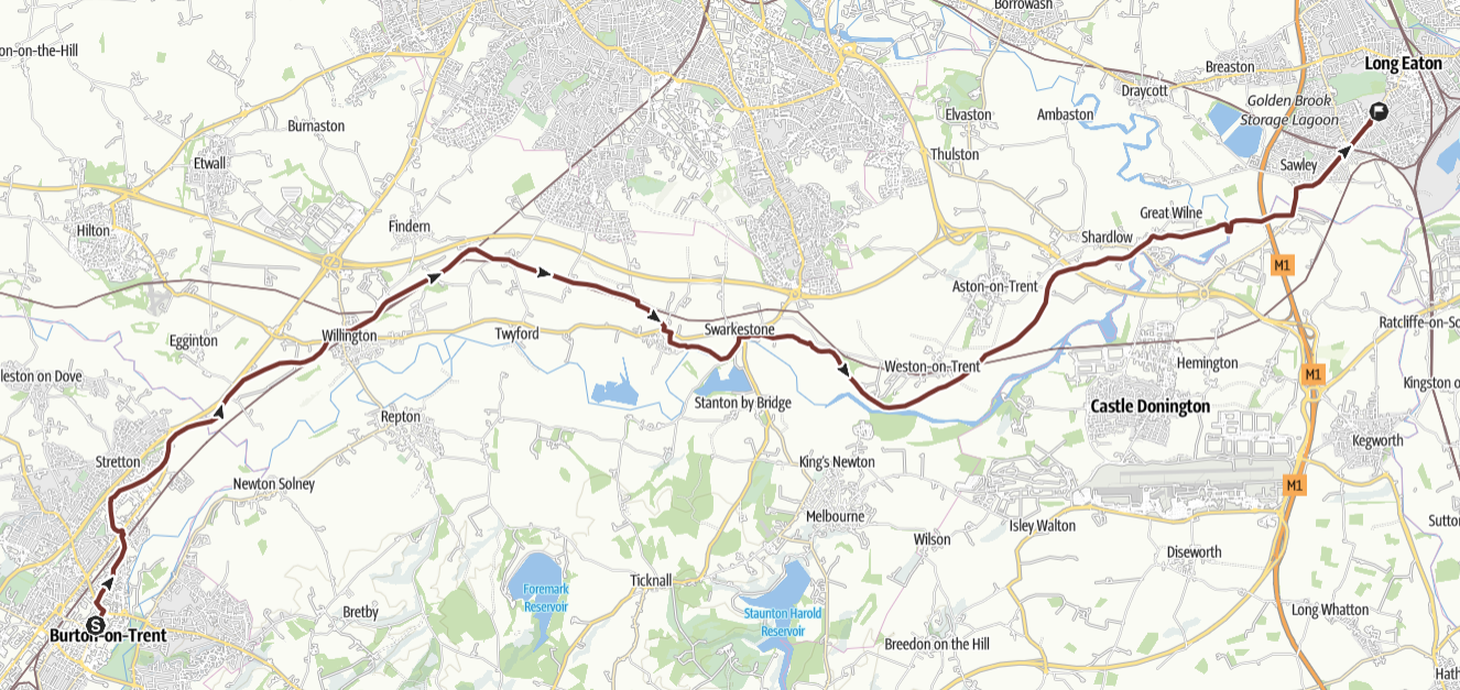 THE ROUTE IN DETAIL
Walk overview
A long day, mostly beside canals and rivers.
Details
Distance: 20.5 miles
Approximate time taken: 9 hours walking
Ascent: 62 ft
Where to join: SS Mary & Modwen Catholic Church, 78a Guild St, Burton-on-Trent, DE14 1NB
Time walk starts: 8am
Where walk ends: St Francis of Assisi Catholic Church, 199 Tamworth Rd, Long Eaton, NG10 1DH
Approximate time walk ends: 6pm
Accessible sections:
1. Burton St M & M until River Dove Aquaduct. (Opportunity to leave canal path at Mill Stream Lane, Stretton)
2. Tamworth Road to Long Eaton station
Shorter walk options
SS Mary & Modwen, Burton on Trent to Willington, distance 5.3 miles, start 8am, ETA 10.30 am
There is a railway station near the route in Willington.
Stage 15: Long Eaton to Nottingham, Saturday 13th September 2025
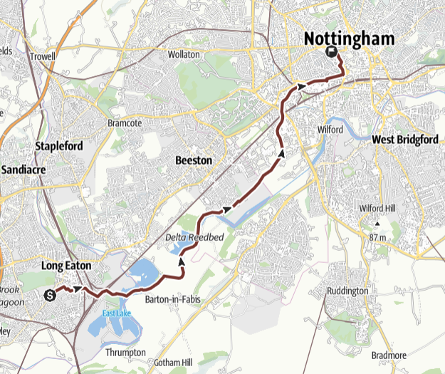 THE ROUTE IN DETAIL
Walk overview
Short walk beside canal and river into central Nottingham.
Details
Distance: 8.8 miles
Approximate time taken: 4.5 hours walking
Ascent: 112 ft
Where to join: St Francis of Assisi Catholic Church, 199 Tamworth Rd, Long Eaton, NG10 1DH
Time walk starts: 9am
Where walk ends: St Barnabas Cathedral, N Circus St, Nottingham, NG1 5AE
Approximate time walk ends: 4pm
Accessible sections: All route but NB
there is a small section of the path around the Attenborough reserve which is mud track. If there has been wet weather it might be best avoided.
Shorter walk options
None planned as a short day.